
MOLAVE: Humble Beginnings
During the 1920’s a huge group of people from Luzon and Visayas, left their homes and migrated to Mindanao, seeking fortune and a good life in the southern part of the Philippines. Some of these settlers were able to find lands in the current Zamboanga peninsula, which gave birth to the prominent towns and cities of the del Sur and del Norte region.
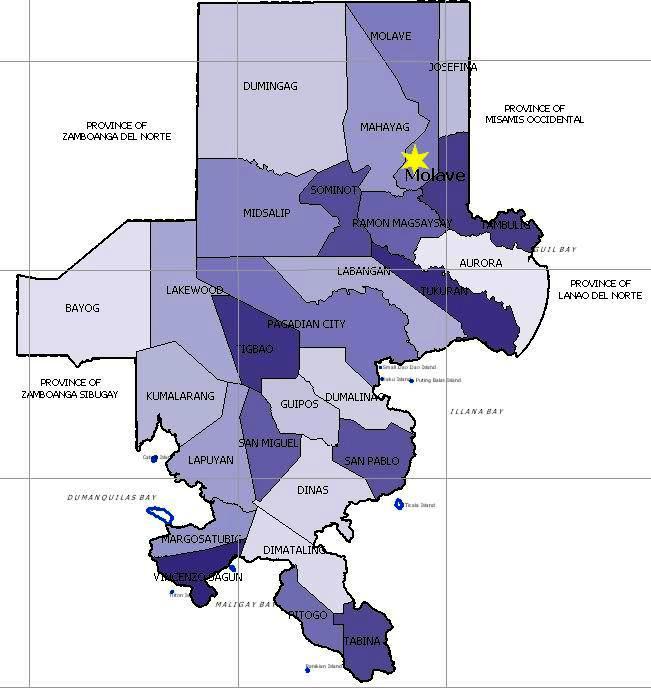
Some of these places became the pillars of development during the young, frontier days. Fostering the bases for agricultural, social, and economic growth in their respective areas. Today, these places have become a beacon of stability and progress and is still continuing to grow bigger and stronger for the future generations. One of these places is the humble, yet bustling town of Molave, the heart of the Salug Valley.
But before Molave grew to a progressive Class A Municipality it is today, it first started as a humble barangay under the Aurora town, known as Salug, and is a land surrounded by swampy lands, forests, hills, and watersheds that made it viable for the indigenous people live in.
The Subanen tribe has lived in the lands for generations before they encountered the first settlers. Using kaingin as their farming method, they were able to clear out huge chunks of forest in the flatlands and cultivated the land with indigenous crops like corn and some native rice.
During a period of migration to the south, most of the lands the Subanen tended were emptied and sold to the new migrants. Through an old trading method, the barter method, the migrants were able to purchase huge hectares of land by trading salt, clothing, and other items that were new or significantly important to the survival of the indigenous people.
Over the years, through that same exchange, the settlers from Visayas were able to own huge portions of land that comprises the whole of Salug. Some of these settlers were the lineage of the prominent families of the humble town that established Molave into a town of its own that it is now.
The pioneering families who have acquired significant areas of land and settled in the municipality were- the Lobitañas- said to be the first to acquire lands from the Subanens that stretched from what is now Barangay Sudlon down to a huge portion of Barangay Gabunon. The Guillens, the Blancias and the Ariosas. In the other part of town, families like that of Col. Villasis and the Maestrados have also significantly established settlements that even up to present, sitios in Barangays Miligan and Culo are named after them. Other emerging families like the Lumapas clan and the Magtubas followed soon after and settled in the areas known today as the three Brangays that comprises the Poblacion.
During this early period of the town’s history, the place was still a slumbering barangay slowly being filled with pioneers braving the swamps and forests of Molave but still tending the fields as the Subanens did, albeit in a more industrial, progressive manner.
But as people from Luzon and Visayas migrated further to the south, the town was slowly filled with families that had a lot more to offer than just farming and agriculture. Slowly, the vast fields were converted into places of living and commercial expanses- a development fostered both by local settlers and several Filipino-Chinese clans.
More infrastructure was placed to cater the needs of the growing town. Water and sanitation have become an important factor to the town’s growth. A lot of jetmatics were erected to help sustain the growing population, overshadowing the use of wells in the area. During this time, more roads were also paved for the growing number of people going in and out of the barangay. Somewhere along the transition as a bustling area of trade and commerce, the name Salug was changed to Molave, the distinguished town we all know today.
On June 16, 1948, the growing town of Molave has finally seceded from its mother town of Aurora and became its own municipality. The creation of the municipality was made possible by the former congressman, Hon. Juan S. Alano authorizing Republic Act No. 286 titled, An Act Creating the Municipality of Molave in the Province of Zamboanga and making said Municipality the Capital of the Province. Unfortunately, the town never bested Dipolog City as the then provincial capital.
Regardless, Molave carried on and along with being a new municipality came its first officers to lead the young town. Hon. Pelagio Blancia and Saturnino Mendoza became the first mayor and vice-mayor respectively by means of appointment.
Mayor Pelagio Blancia, along with his appointed council met regularly on their makeshift government office, the first floor of Pelagio Blancia’s house. In there, they would convene and pass ordinances that supported the growth of their beloved town.
During their time, they were able to build bridges that connected the town from its Sitios, erected schools, paved more ways, created more precincts, and infrastructures that became the steppingstone towards Molave’s urbanization through the creation of the Molave waterworks and the first electricity concession.
In 1951, the first town election was held. Javier Ariosa emerged victorious on his campaign and seated as the first elected Mayor of the town. He also transferred the government’s seat of power from Camp 7 into the Poblacion, ushering in the shift of town activities into the official townsite. This was also the start of construction for the Municipal Hall that used to be in the municipal building’s current place in Poblacion.
During his office, he and his council was able to build on the foundation Hon. Blancia and the previous councilors made and created more infrastructures and amenities for the people to have a better life while living in the blooming town. This ushered Molave’s growth and in turn becoming an influence in the Zamboanga peninsula.
Slowly, Molave emerged into the modern town that we know today, with a bustling local economy, primarily driven by local industries. sThe efforts of the pioneers and the previous officers proved to be paramount to Molave’s development. From their ordinances that emphasized on sanitation to their urbanization plans and land use, they created a town not just of agricultural significance, but also a town of economic importance due to the booming and successful businesses that built their foundations in Molave.